Assessing Bike Lane Conditions with Computer Vision
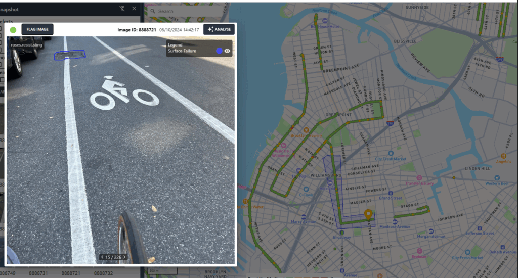
SmartVision’s Road Surveyor mobile application captures images of protected bike lanes and automatically assesses road conditions, including potholes, cracking, and water pooling.
Automated Building Façade Inspections
T2D2’s AI software analyzes the building façade at the Jackie Robinson Recreation Center to detect corrosion and other structural defects
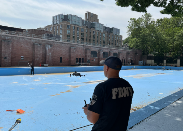
Analyzing Vehicle Flows Related to Industrial Activity
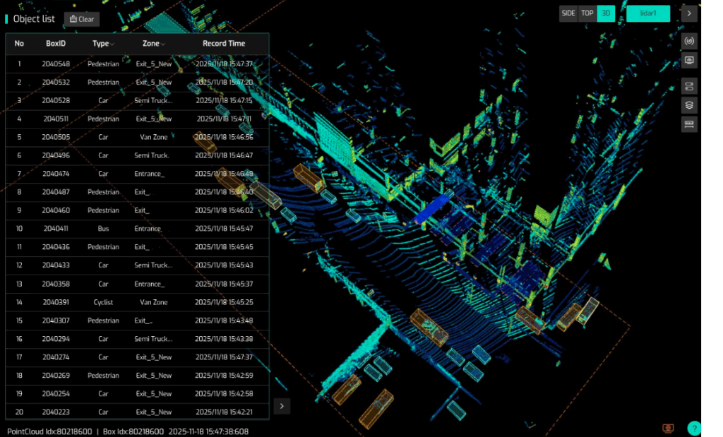
Seyond’s LiDAR and AI technology collects and analyzes data to generate insights into vehicle flow rates in industrial areas.
Augmented Reality-based Public Engagement for City Building Projects
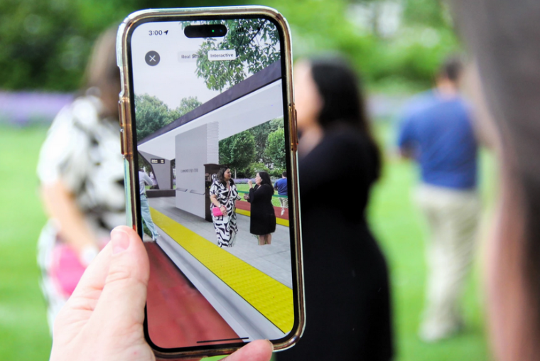
inCitu’s augmented reality (AR) technology offers community members an immersive preview of proposed future developments.
Pedestrian Counting in Public Spaces

Meshed’s pedestrian sensor technology generates data to quantitatively understand pedestrian activity on highly crowded streets.
Earlier Smart City Testbed Pilots
Sensing Street Activity with Computer Vision
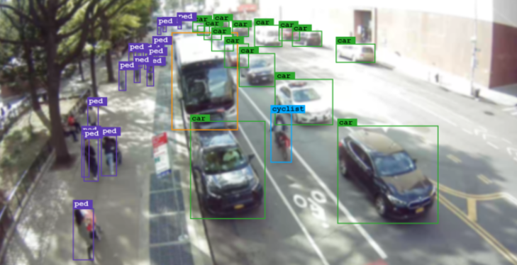
Vivacity’s computer vision sensors conducted volume counts of roadway users and generate street activity data, allowing DOT planners to better understand city streets and inform future street redesign.
Air Quality Improvement and Monitoring

Static Air’s particulate matter reduction system and Clarity’s air quality monitors worked in tandem to collect hyperlocal air quality data while simultaneously working to improve air quality.
Improving Energy Efficiency of Buildings with Robotics

Building Diagnostic Robotics created robotics equipped with ground-penetrating radar (GPR), thermal imaging, and an AI to identify building envelope issues.