
The Department of Transportation’s (DOT) Office of Livable Streets team plays an important role in developing public spaces, such as Pedestrian Plazas and Open Streets. As residents and visitors utilize space created by the Open and Summer Street programs, the DOT wants to know how many people visit these areas quantitatively. Currently, DOT relies on manual or video-based pedestrian counts, which are static, require additional time to produce insights, and do not capture critical metrics like dwell time. To address these limitations, DOT is interested in anonymized pedestrian counting technologies that can be easily deployed across open streets, plazas, and markets.
By getting better pedestrian count data, DOT can improve public space management, enhance pedestrian experiences, and position New York City as a leader in creating vibrant, safe, and engaging destinations.
Opportunity: Meshed, an Australian-based IoT company, uses sensors to anonymously count the number of Wi-Fi enabled devices that enter and leave a defined zone while also calculating the average dwell time of devices present in that area. From this data, Meshed can provide estimated crowd sizes and dwell times at plazas, open streets, and a holiday market, helping DOT better understand which areas attract the most visitors, when they are busiest, and how long people typically stay.
Methodology: Six of Meshed’s pedestrian counting sensors (nCounters) will be deployed across as many locations for a total of three months during the Winter of 2025 with the support of The Things Network, New York (TTN NY) . The units will include solar-powered models designed for quick installation and removal on City-owned assets, making them ideal for temporary seasonal deployments.
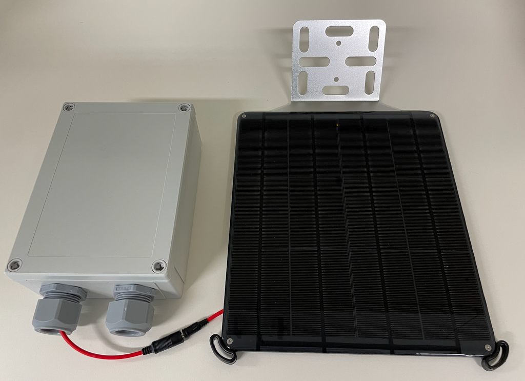
To enable backhaul connectivity, LoRaWAN gateways will be deployed near the nCounter installation sites. These gateways will be installed on City-owned assets, likely in collaboration with the Department of Parks and Recreation (DPR). Each nCounter is capable of counting up to 300 devices per 10-minute interval, capturing aggregated activity within its zone. The counters will transmit anonymized, aggregated data to the nearest gateway, which will forward it to a network server. From there, the data will be sent to Meshed’s cloud-based platform, where it will be stored securely, processed, and made accessible through dashboards.
Location: Areas in Queens, Brooklyn, and Manhattan.
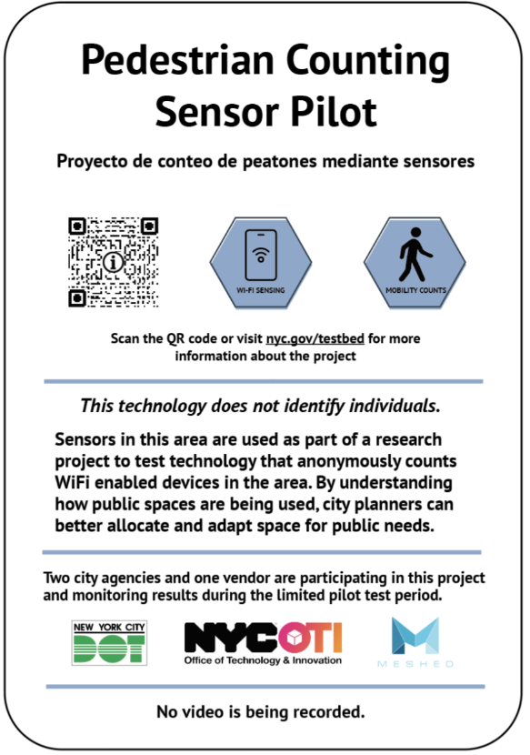
Signage: The below signage communicates to the public that the pilot is purely research-based, and no personal identifying information will be collected.
Project Timeframe: June 2024 – March 2025
| Stakeholders |
| Department of Transportation (DOT) |
| Office of Technology and Innovation (OTI) |
| Department of Parks and Recreation (DPR) |
| Meshed |
| Project Category |
| Mobility |
| Wi-Fi sensing |
| LoRaWAN |