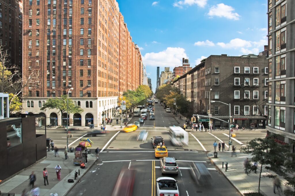
Currently, the Department of Transportation (DOT) conducts volume counts of different roadway users (e.g. cars, trucks, pedestrians, bicyclists) to better understand travel trends, demand, and the safety of City facilities. Additional data on intersection turning movements, speeds, double parking, loading zone use, and other behaviors are also collected to better understand how streets are being used and evaluate the effect of any changes made to them.
This data is typically collected through time- and person-intensive methods of manually coding data or overseeing partially automated analyses. Where automated non-motorized user counts can be collected are often limited to permanent installations and specific facilities like off-street paths. All of these data collection methods are either expensive or limited to one day or both.
Opportunity: In 2020, the Mayor’s Office of the Chief Technology Officer (MOCTO), now a part of the Office of Technology and Innovation (OTI), in coordination with DOT, applied for a Smart City Innovation Partnership grant from the NYS Empire State Development corporation. The project received a grant which amounts to a matched total of around $100,000 for the pilot. These funds are being used to execute on the project proposal where 12 computer-vision sensors have been installed across four boroughs for the duration of the 8 month pilot.
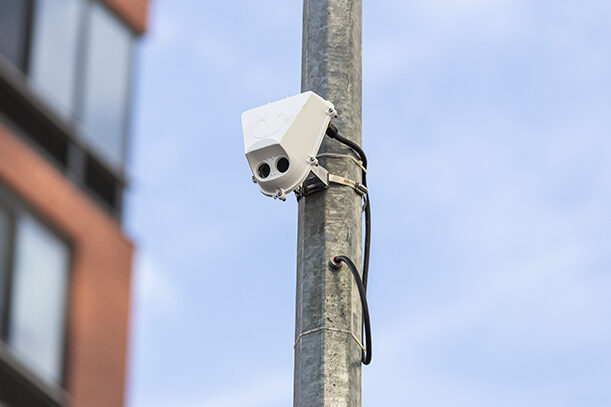
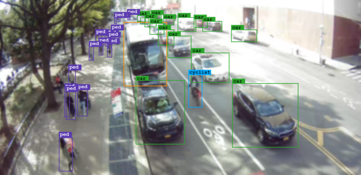
The technology collects street activity data to generate detailed reports that will allow planners to better understand the uses of city streets and inform future street redesigns. The device views the street via a camera, then classifies and counts roadway users in real-time. Video frames from the sensors are deleted nearly instantaneously, and only anonymous features are stored.
Methodology: The devices combine a camera sensor and on-board computer to process live video which provide counts of cars, buses, trucks, bicycles, and pedestrians. Information such as speed, turn counts, dwell times, and conflicts are also reported. The data, not video, is stored in a database and accessed through a visualization software.
Locations:
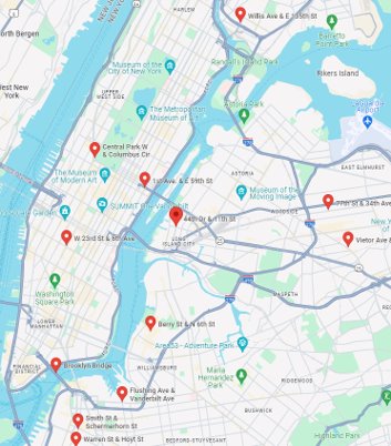
- Schermerhorn Street and Smith Street
- Flushing Avenue and Vanderbilt Avenue
- Berry Street and North 6th Street
- Hoyt Street and Warren Street
- Willis Avenue and East 135th Street
- Central Park West Drive and Columbus Circle
- 1st Avenue and East 59th Street
- Brooklyn Bridge
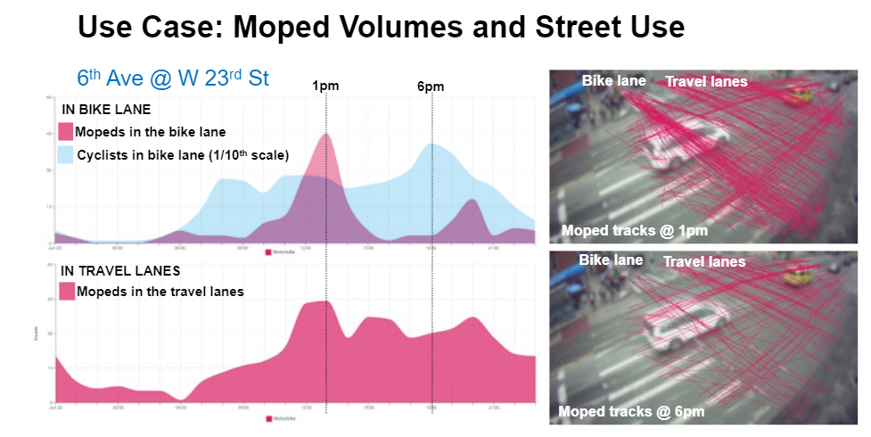
- 6th Avenue and West 23rd Street
- 11th Street and 44th Drive
- 34th Avenue and 77th Street
- Broadway and Vietor Avenue
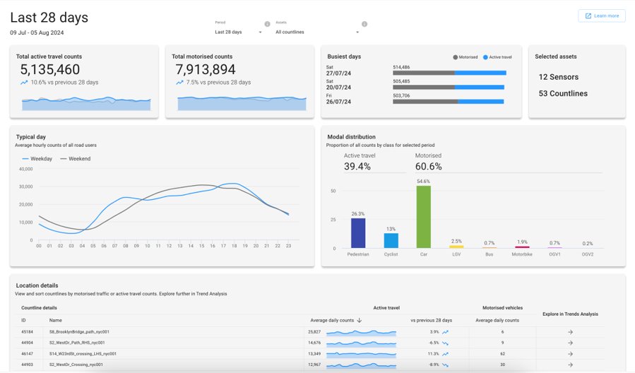
Data Analysis: The DOT was satisfied that the Viva sensors can accurately count all user classifications during both light and dark conditions.
Overall Evaluation: After reviewing the data from this pilot, the DOT has decided to extend the use of the sensors as of September 2024. The sensors remain at the listed locations.
Project Timeframe: July 2023 – August 2024
| Stakeholders |
| Vivacity |
| Department of Transportation (DOT) |
| Office of Technology and Innovation (OTI) |
| Project Category |
| Mobility |
| Computer Vision |
| Artificial Intelligence (AI) |