
New York City is becoming increasingly cycle-friendly with over 479 miles of bike lanes and 180 miles of protected bike lanes (PBL) since 2014. As part of the City’s ongoing commitment to cyclist safety outlined in the 2019 Green Wave Plan, the Department of Transportation (DOT) is focused on improving the condition and maintenance of this infrastructure to support the growing number of cyclists. To enhance these efforts, DOT is exploring innovative technologies that can further strengthen safety, efficiency, and overall infrastructure quality.
Opportunity: SmartVision, an England–based company that uses computer vision and artificial intelligence to assess roadway conditions, piloted their technology with the City to develop a framework to automate the assessment of road conditions in PBLs. Through its Road Surveyor mobile application, SmartVision securely capture images of the roadways, processed the images using their AI, and produced insights into which segments of road have condition defects.
Pavement condition defects:
- Cracking
- Hardware
- Potholes
- Surface failure
- Joint failure
- Pooling
- Surface repairs
Methodology: Five of DOT’s Highway Inspection and Quality Assurance (HIQA) team members installed the Safter Travel Around Neighbourhoods (STAN) app on their DOT-issued work phones. Each phone was mounted securely on a DOT bicycle using a phone holder. During rides, the HIQA cyclists activated the STAN app, which automatically captured imagery at a rate of approximately one photo every 0.07 seconds. To minimize distraction, the app’s display goes black while operating.

At the end of each ride, cyclists ended the session in the STAN app, prompting all captured imagery to upload via Wi-Fi or cellular connectivity to the SmartVision platform. Within SmartVision, authorized users could log in to review mapped ride routes and the associated photos.

After completing the data collection phase, the HIQA team deleted the STAN app from their work phones, restoring them to standard configurations. The DOT’s HIQA team conducted a two-month data collection pilot across all five boroughs.
Data collected resulted in a total of:
- 150,000 images collected
- 209 total miles cycled
- 22,864 unique road chunks analyzed
- 142 miles of total area analyzed
Because the SmartVision AI model was initially trained using images from the streets of the United Kingdom (UK), the project team manually reviewed numerous photos and flagged instances where the AI failed to accurately identify a defect. SmartVision’s engineering team collaborated closely with DOT and OTI in this iterative process to refine the inference model, an AI model that has been trained to see patterns, based on this feedback. Through repeated cycles of manual validation and model adjustment, the SmartVision AI’s accuracy improved significantly, enhancing its ability to correctly identify pavement defects in local road environments.

Location: DOT’s HIQA team collected data from PBLs in all five boroughs.
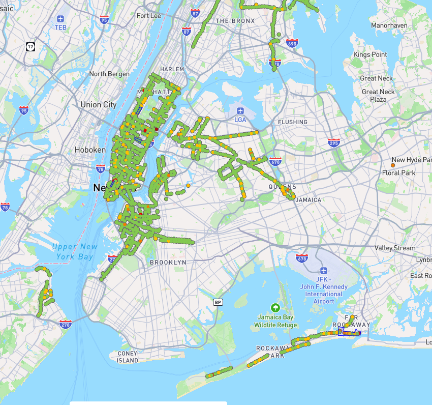
Project Timeframe: February 2024 – November 2024
- New processes were created to work with SmartVision, a non US-based organization, which added a additional time to the overall timeline.
| Stakeholders |
| Department of Transportation |
| Office of Technology and Innovation |
| SmartVision |
| Project Cateogory |
| Mobility |
| Computer Vision |
| Artificial Intelligence (AI) |